
Streamline your planning process. Tended allows planners to view sites and work areas in great detail, reducing the need for extensive pre-site surveys.
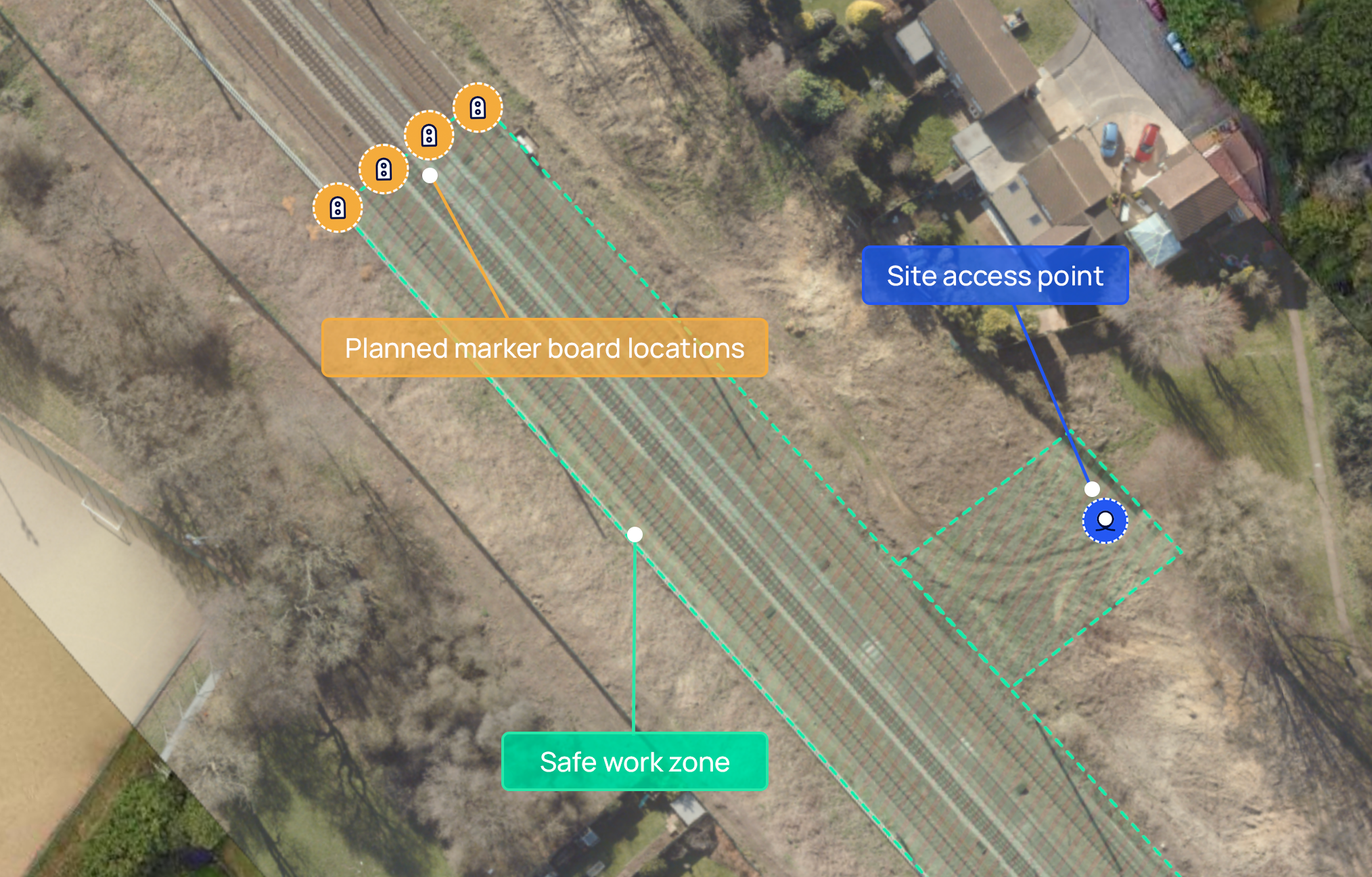
Put an end to confusion around the location of access points and safe work areas. Easily create virtual safe, warning or danger zones, define safe access points and walking routes, plot the location of critical protection equipment and more to provide real-world context to your teams.
Set a time and date for your safe work zones to suit work schedules. Once a geofence zone is stopped, alerts notify your teams to move to a position of safety, helping them stay out of harm’s way when hazardous activities are scheduled on site.
Input a few details from your project plan into the Dashboard and Tended’s system will automatically create a geofence to the specified size and location. Highly accurate zones mapped out in seconds.

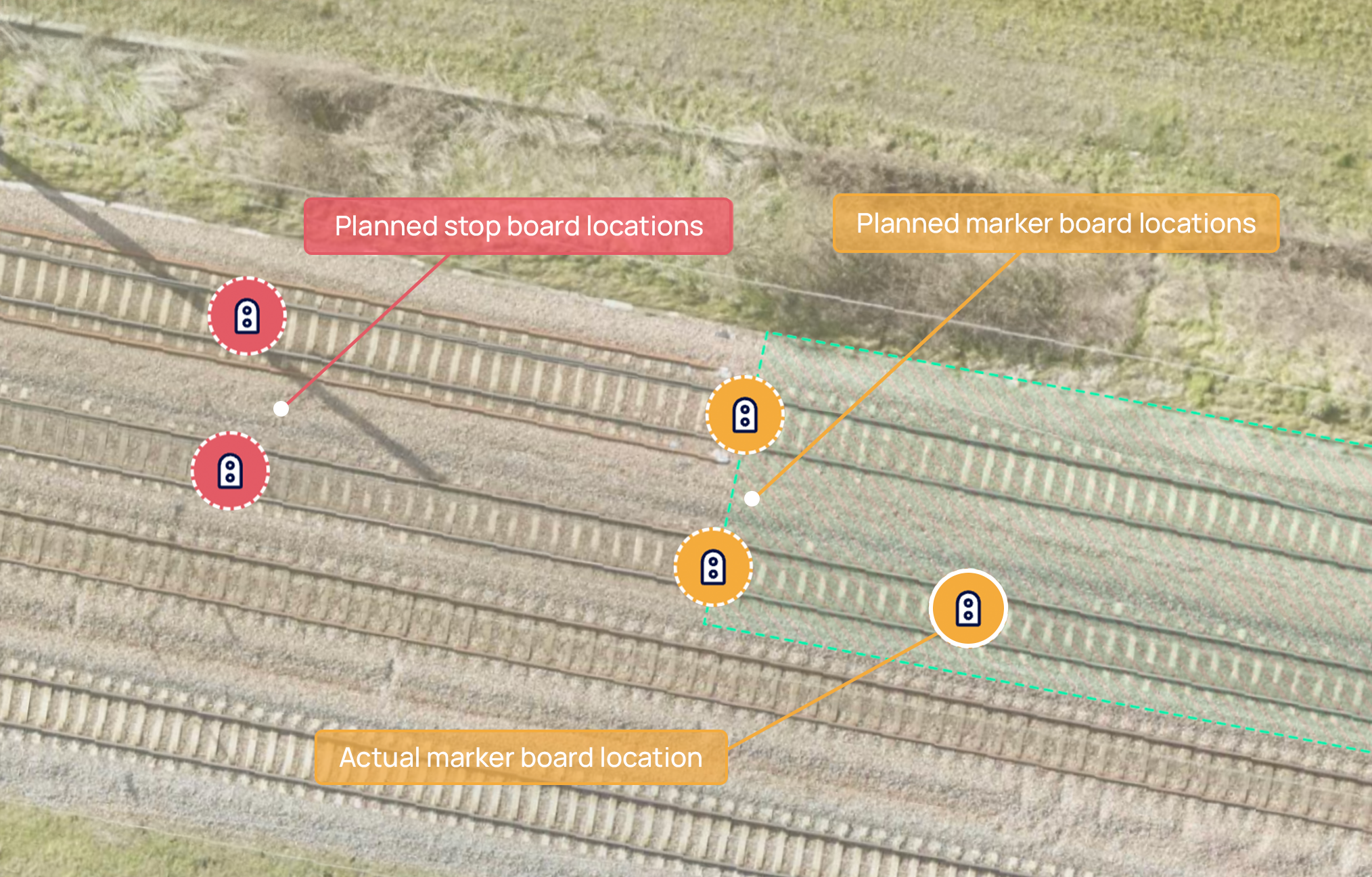
Easily plot the location of protection equipment with rail-specific data like track IDs and miles and chains. Monitor their live location in real time to check they’re placed in the correct location and recovered after works.
Reduce the risk of error with built-in approval workflows. Inspect the change history of all plans and view comprehensive audit trails to check that sites are set up correctly and are compliant.

With a growing list of features, you can be sure you have the most comprehensive safety solution available.
Access the Dashboard from any location using a desktop, laptop or tablet with an internet connection.
Overlay your existing digital geospatial data, such as the position of your fixed assets, within the Dashboard to enable better-informed planning.
Make informed planning decisions by switching on rail-specific overlays that include miles and chains and ELRs.
A what3words integration makes planning more efficient by making exact site locations quick and easy to find.
Accurately measure any distance onsite, such as the distance from the edge of a track or size of a safe zone.
Save time by mirroring your safe systems of work and set projects up in less than 5 minutes.
Book a free onsite demo to see Tended’s revolutionary geofencing technology in action.